Canada
Vancouver: the harbour, Stanley Park and the mountains behind the city.
All six photographs in this gallery were made on one day, 18 April 2026, in Vancouver. Downtown sits on a peninsula between Burrard Inlet and English Bay, with the Coast Mountains rising directly behind the north shore.
Stanley Park covers about 405 hectares. Its seawall, finished in 1980 after 63 years of work, runs for about nine kilometres around the park and is the easiest way to see the skyline from the water.
The skyline photographs look across False Creek, the inlet south of downtown. To the north, across Burrard Inlet, Grouse Mountain and the other North Shore peaks stay in view most of the day. The cherry trees were in flower on the day these were made.
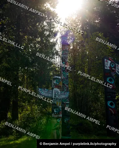
Stanley Park opened in 1888 and is larger than New York's Central Park. The totem poles at Brockton Point, on its eastern side, are among the most visited sights in British Columbia. The first poles came to the park in the 1920s, and several of the ones standing now are newer carvings by First Nations artists.
Vancouver has tens of thousands of ornamental cherry trees, many of them descended from gifts from Japan in the 1930s, and they flower from March into April.
Grouse Mountain, the nearest of the North Shore peaks, rises to about 1,230 metres.
The set covers the skyline from the water, the totem poles in Stanley Park and the cherry trees in bloom. Each photograph is available as a print or under a licence.